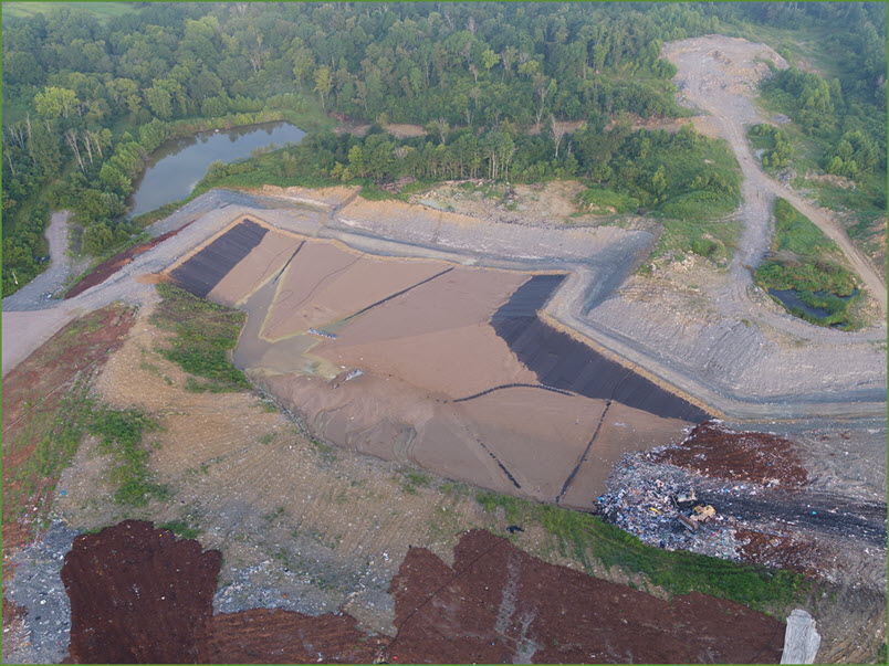
Kenvirons offers comprehensive civil and environmental surveying services that are founded on years of experience with municipal, industrial, and private clients needing cost-effective expert surveying. Our extensive experience includes both traditional ground-based surveys as well as advanced surveying using UVA drones. We serve our clients with the engineering and technical skills to provide expert mapping, photo surveys, construction surveys, boundary assessments, flood elevation surveys, and may others.
We provide our clients expert survey services with state-of-the art Global Positioning System (GPS) equipment using base stations and portable GPS technology. Our experienced surveyors have the proficiency to perform a wide array of GPS survey activities.
Kenvirons has extensive experience conducting construction surveys using both land-based GPS and total station survey technology and UAV-drone technology. Our equipment and experience allows us to deliver to our clients the survey services necessary to maintain construction projects within scope, on-time, and on-budget.
Our UAV-drone capabilities over the last several years have served our clients with detailed aerial mapping services for any size project. Kenvirons’ personnel utilize the latest drone and software technology to deliver mapping services at competitive costs without compromising detail or accuracy.
Kenvirons has performed boundary surveys for many different clients, including municipal, industrial, and private entities that require the highest level of service. Our traditional land-based equipment capabilities coupled with our experienced personnel can handle any boundary survey needs including deed research and plat development.
We provide our clients with topographic mapping services using land-based and UVA-drone technology. This technology, coupled with our knowledge and proficiency using the latest advanced mapping software, gives our clients the topographical mapping they require at competitive costs.
Our survey capabilities include establishing horizontal and vertical controls that serve as reference for subsequent surveying based on the NGS survey reference system or local site systems. These services are key elements to surveying that Kenvirons routinely performs to provide permanent or temporary control points such as monuments, benchmarks, aerial control, etc.
We provide volume and operational surveys to our clientele using our UVA-drone, GPS and robotic total station equipment. Whether it is simple stockpile surveying, waste fill staking or detailed landfill airspace determinations, our survey staff is equipped to provide the highest level of survey accuracy.
Over the years Kenvirons has provided clients with surveying services to establish and complete flood elevation certificates, letter of map amendments (LOMA) and conditional letter of map revision (CLOMR).


